
The Maquette of São Paulo City in 1840 is in Museu Paulista and its restoration is part of the exhibitions preparations of the New Museum of Ipiranga in 2022 to celebrate the 200 years of Brazil’s independence.
It was made in 1922 by Henrique Bakkenist based on cartographic maps from the 19th century.
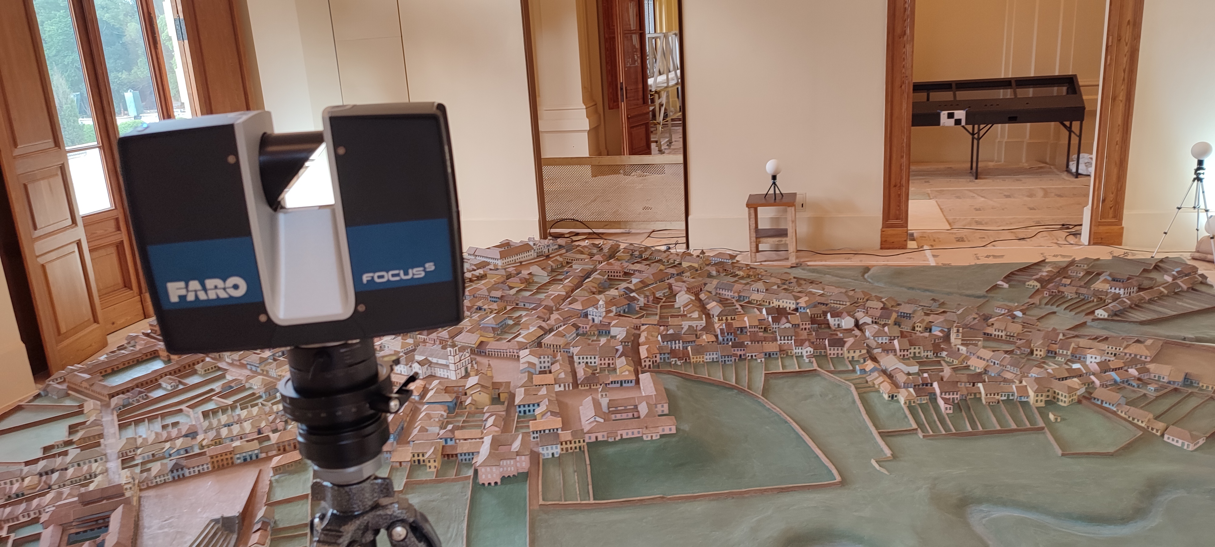
The Huginn Flying was hired by Pauliceia Arquitetura e Restauro to perform the 3D scanning of the Maquette and serve as a basis for the damage mapping elaboration, one of the restoration process requirements .
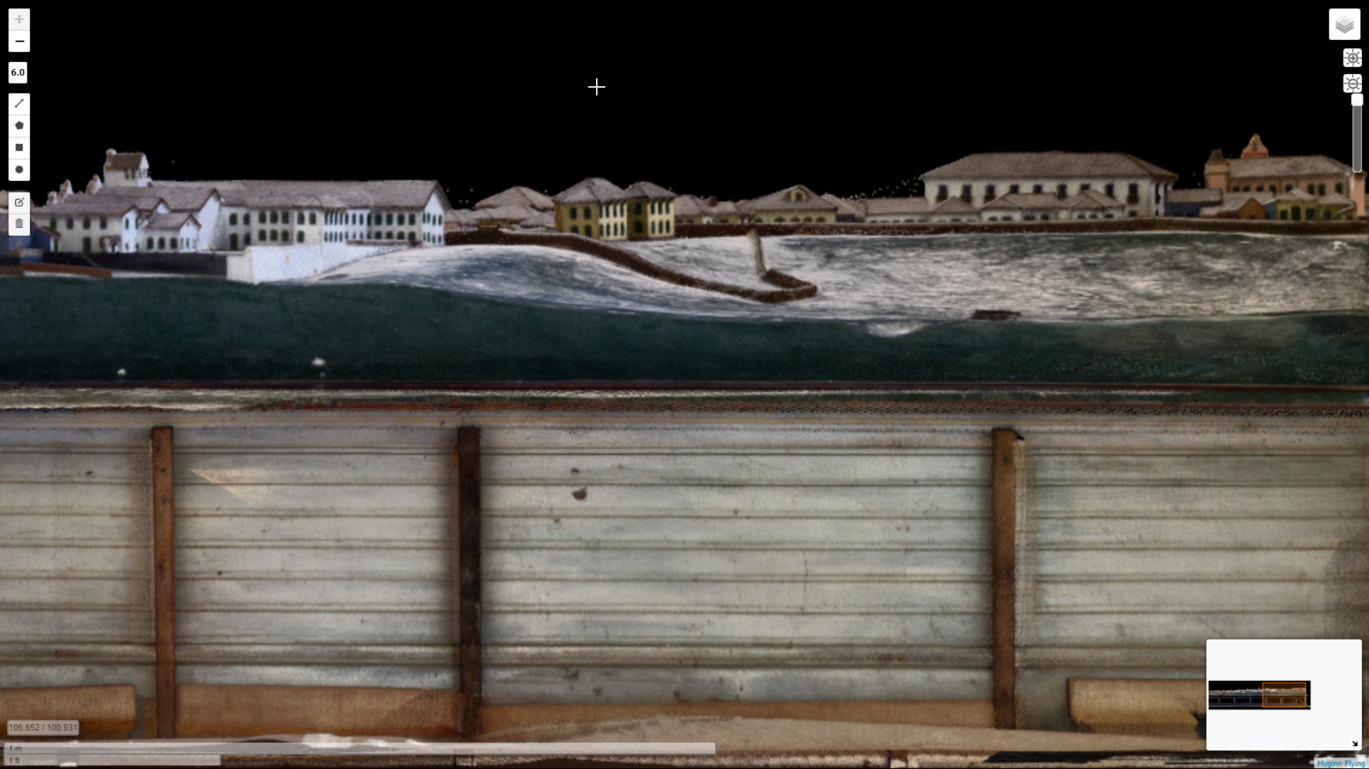
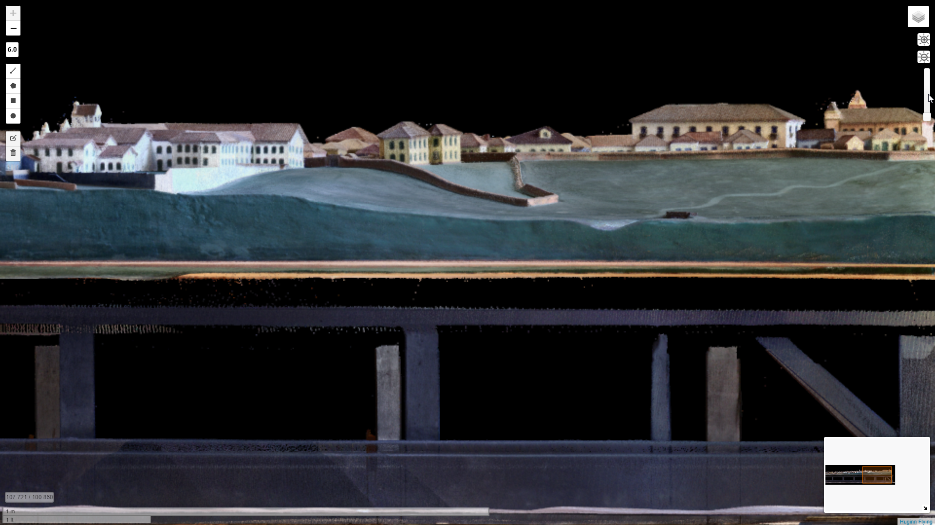
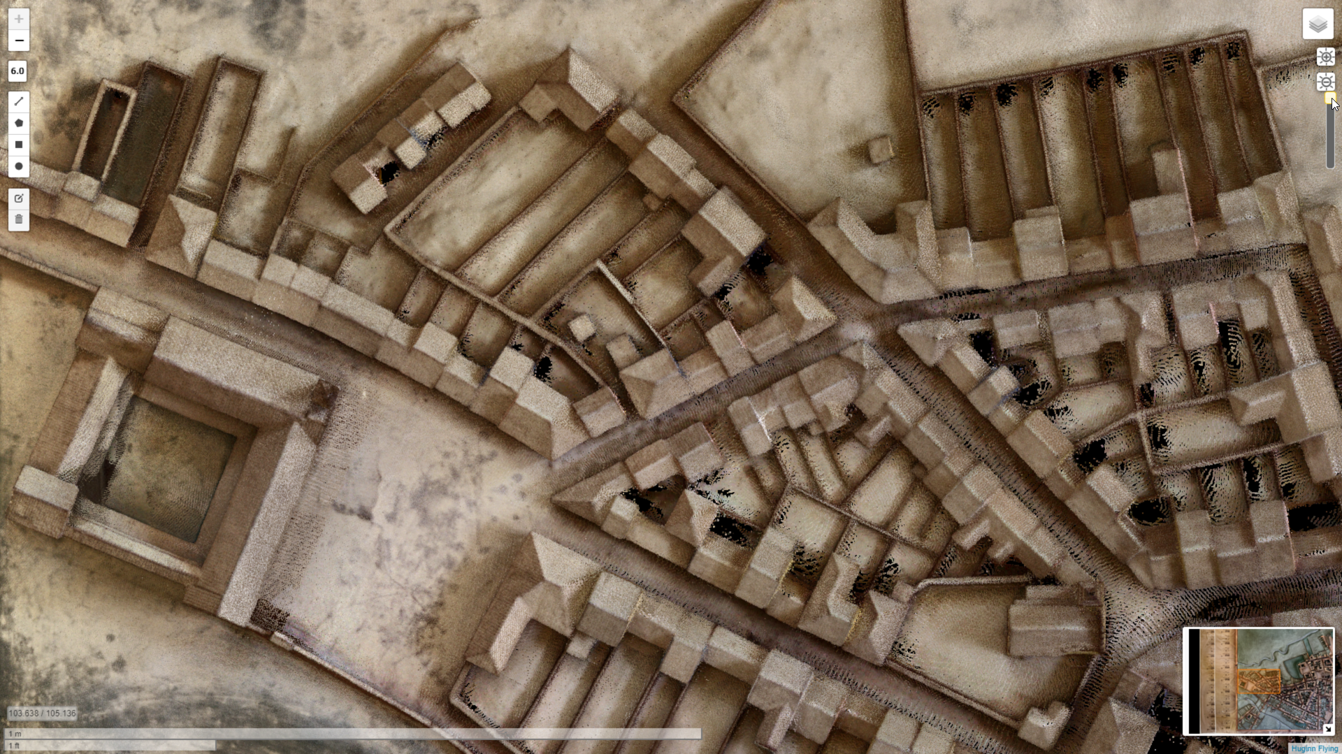
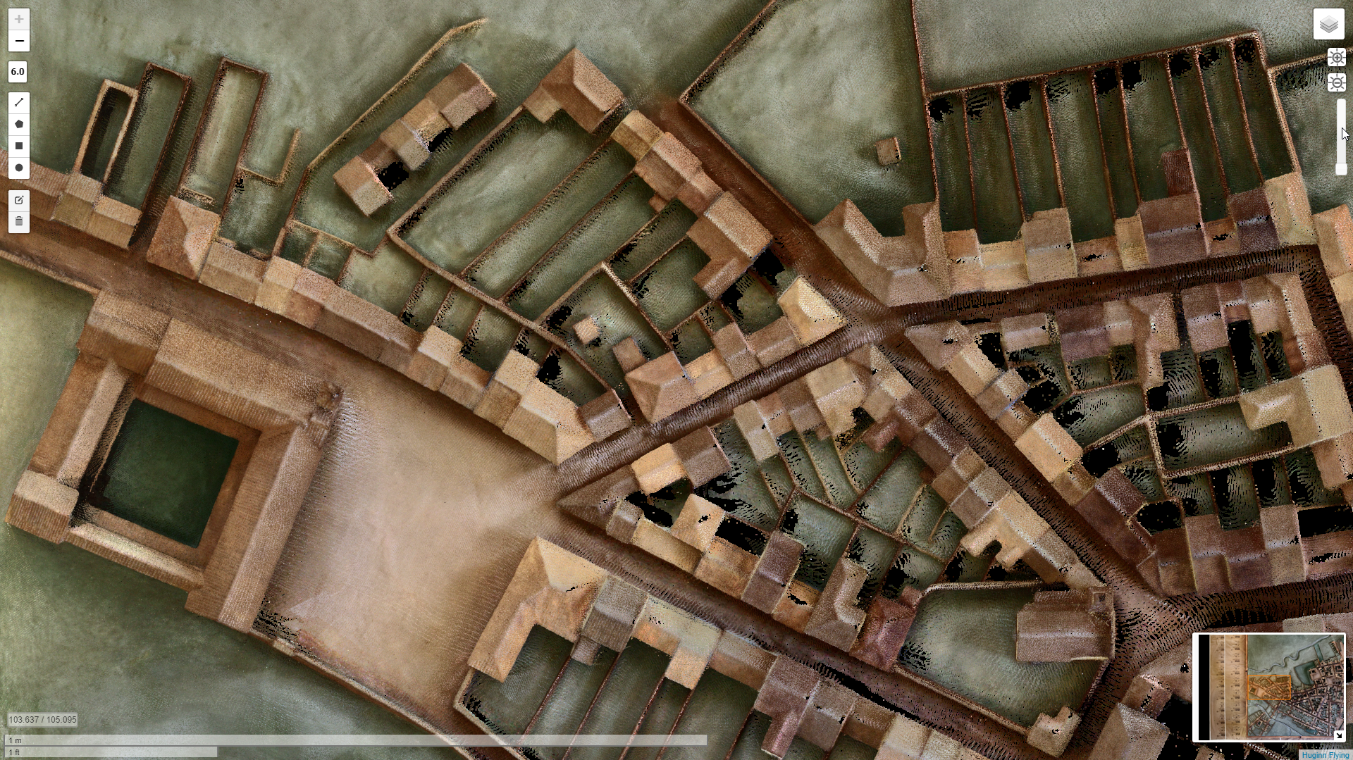
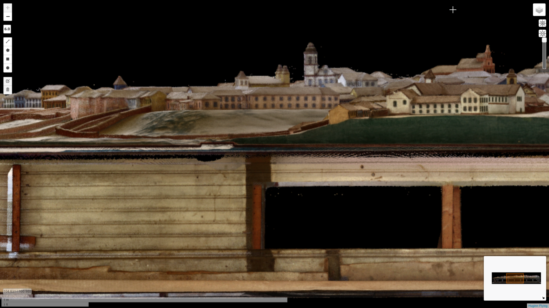
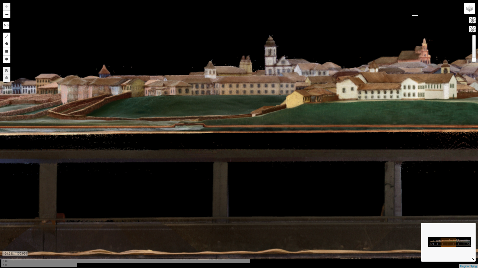
From the point cloud (model) orthophotos were generated at the scale of 1000 pixels per meter (one pixel per millimeter) that were used in damage mapping.
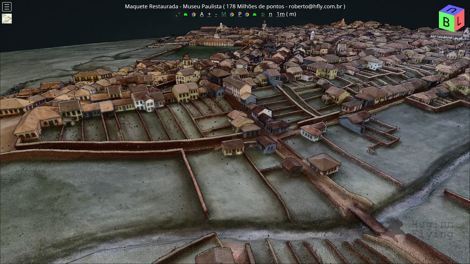
At the restoration services conclusion, the idea arose of a new 3D scanning session (point cloud), registering the final aspect of the maquette. Naturally we did this post-restoration scanning.
While scanning the model we asked ourselves which buildings were represented in the model and which still exist. We were in doubt about some of them, if they were really the ones we thought.
Although the description of this artwork says that there is no scale gauging, we wondered how correct this maquette was, so we came up with the idea of comparing the maquette’s point cloud with the point cloud of São Paulo City in 2017 (PMSP 2017).
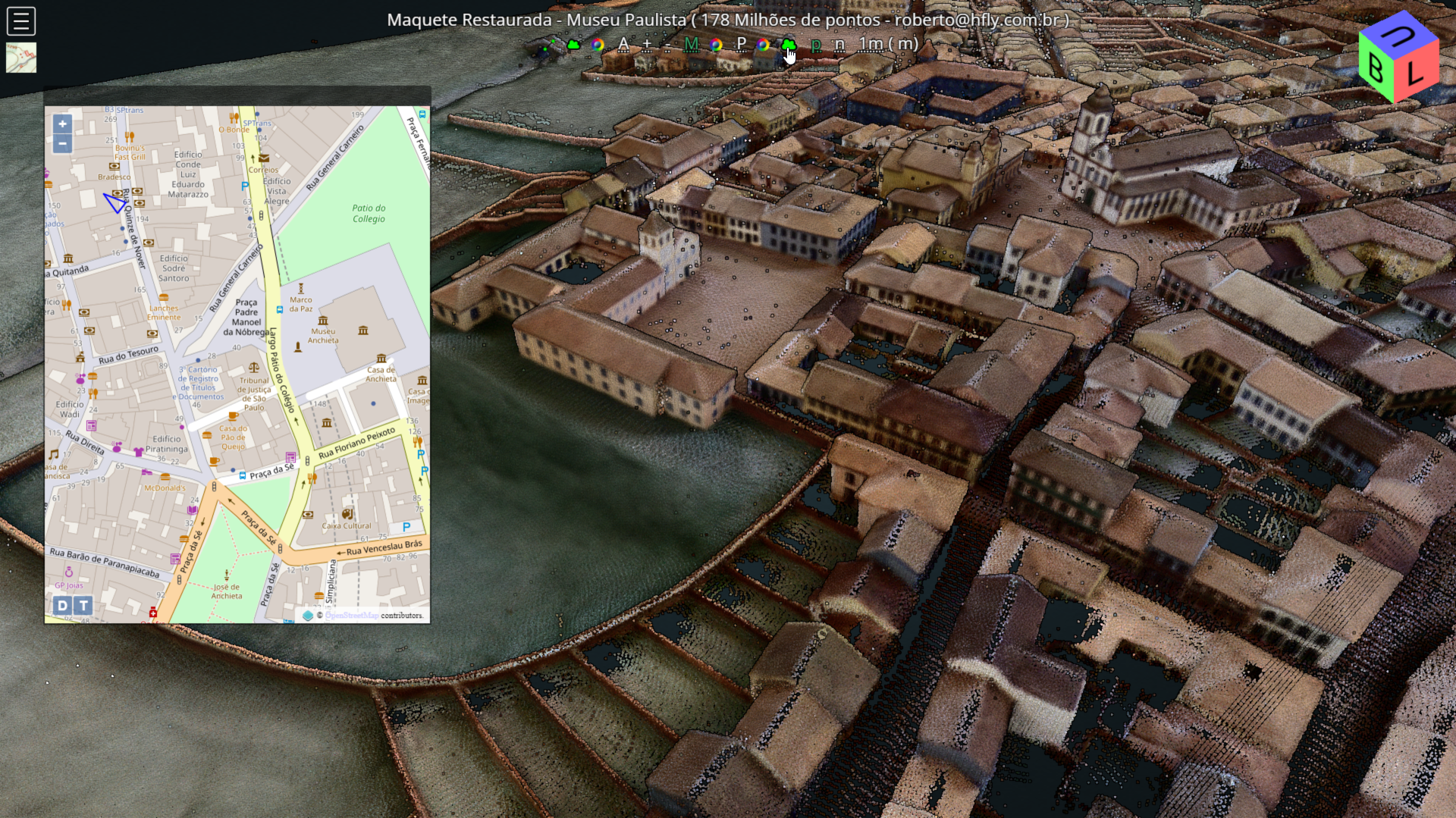
I selected two points at approximately the same locations in both clouds: on top of the Pateo do Collegio tower and on a corner of the Mosteiro de São Bento.
Based on these points, I scaled up and aligned the Maquette’s point cloud with PMSP‘s point cloud, and the result proved to be very close to the present layout of the region. This alignment allowed us to correctly identify the locations and, for us, to discover some buildings that still exist today.
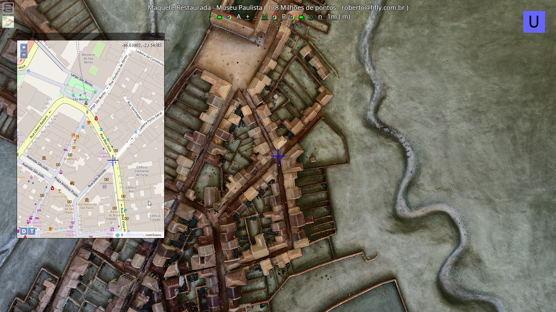
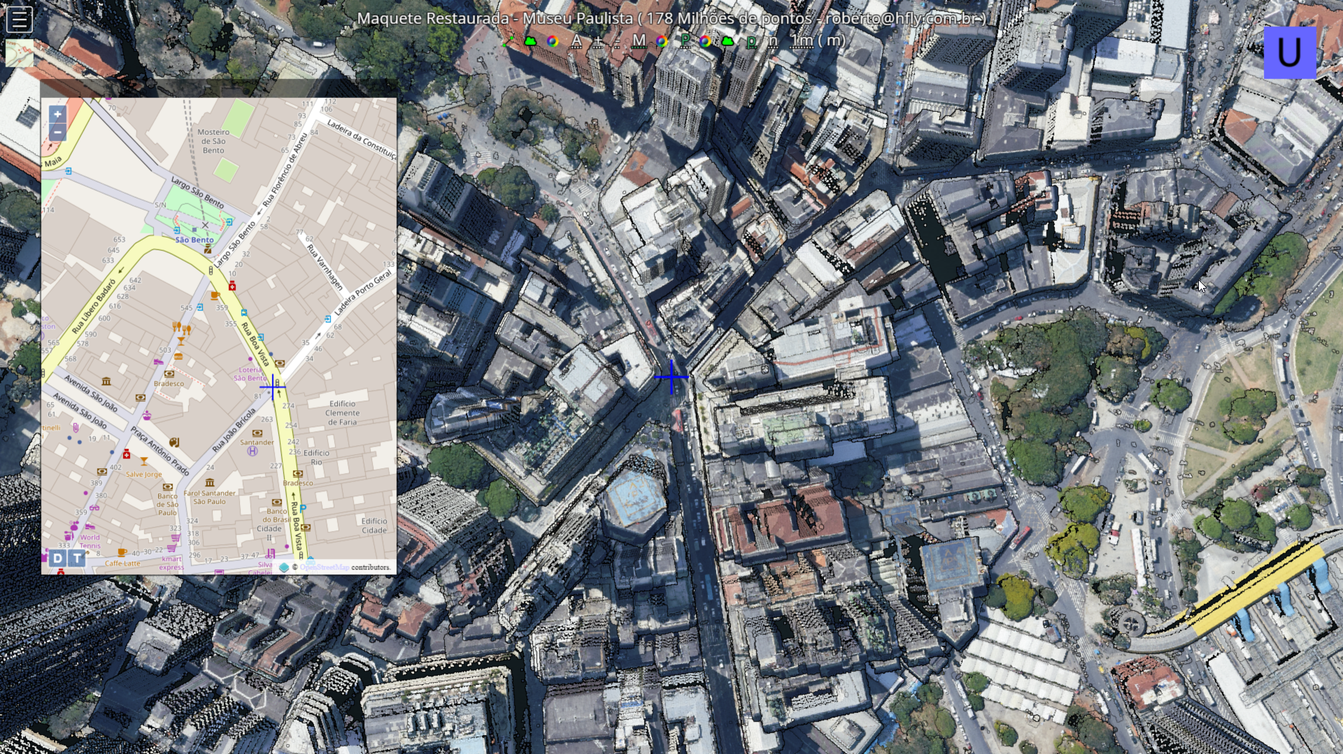
On the HFLY portal one can see the Maquette’s point cloud, the position of the camera on the current map, also the PMSP‘s point cloud and even jump to the 3D view on Google Maps as showed below in the movie “A walk through São Paulo of 1840“.
We recommend watching in full screen, 1080p HD quality.
Use Chapters and jump straight to the desired excerpt.
![]()
Maquette of São Paulo City in 1840 – Novo Museu do Ipiranga

Restoration: Marcelo Sancho and team

Graphic Records and Final Report: Mita Ito
![]()
Laser Scan and Access Portal: Rosário and Roberto